Tuesday, January 29, 2008

Prehistory of the Hill Country, Part Three

Saturday's outing did not end at Etowah. Due to some fuzziness in my geographical knowledge of West-Central Georgia, when I originally planned the day, I had done so based upon the absurd notion that Carrollton and Etowah were much closer than they are. Therefore, I reasoned, viewing the cultural remains of the Mississippian peoples (ancestors to the Creek Indians) at Etowah might be followed, quite easily, by a visit to McIntosh Reserve in Whitesburg, south of Carrollton. McIntosh Reserve was formerly the residence (or rather, one of several of the residences) of a Creek Indian leader, who signed a treaty giving up Creek lands, hastening the exile of his people, which took place several years before the Cherokees had their Trail of Tears. Anyway, the distances between the two sites is quite respectable, and another hour-and-a-half of driving ensued, including an inevitable wrong turn on US 78 in Douglasville. At last, McIntosh Reserve, and the welcome sight of Carole Harper, local historian, waiting to greet us.

After all the visitor conveniences of Etowah Indian Mounds (museum, gift shop -- and yes, I bought another book there, videos, interpretive brochure), McIntosh Reserve is a bit of a shock. The main feature of the park is the grave of Chief William McIntosh: a stone that looks like a turtle when viewed from the right angle, and like a granite boulder covered with colorful lichens when viewed from every other angle; a small gravestone, a later addition, with his name, dates of birth and death, and military rank; and a state historic marker. After signing the Treaty of Indian Springs (identified in a smaller historic marker sign across the road), McIntosh retired to his "Reserve", a square mile set aside for him for the rest of his life, the smallest fragment of the expanse of Creek territory that he relinquished to the whites. He received, too, a large sum of money, but he did not enjoy the money or the Reserve very long, before he was assassinated (or justly executed?) by a band of Creeks opposed to the treaty (which was practically everyone else in the tribe). When he was killed, his home and all his outbuildings were burned, but the money he received as part of the treaty was never recovered. Legends have it that it may be buried somewhere in a parish in Louisiana....

Here, then, is McIntosh's gravestone, in two views. If you squint just right at the lower picture, you might imagine the carapace of a turtle.

Across the road stands a dogtrot home, about the same age as, and similar in appearance to, the house McIntosh lived in. This one was moved from somewhere in Alabama and rebuilt at the Reserve about ten years ago. Several of the rooms are open, but unfurnished apart from an out-of-place ugly upholstered chair. Beyond the house, the land drops away sharply, toward the floodplains of the Chattahoochee River. It was there that the Creek Indians would have their Green Corn dances. But on the day of our visit, the space was in use, instead, by a couple of people flying their remote-controlled model airplanes.

After a short visit to the floodplain (where Carole regaled us with accounts of her family's settlement of the area, and spoke of how many of her Lassiter relatives are buried in a cemetery that is now surrounded by private land), we started on our way out of the park. On the way, we stopped at an old graveyard that had been next to a church once, a ways back. The graveyard supposedly contains the graves of McIntosh's wife, Senoia, and one of his three wives. We scrutinized the gravestones, but most were too worn to be legible. All around us, in the woods, were lines of rock, pretty pink gneisses and yellow-brown chunks of quartite, probably marking out family burial plots. Carole speculated that hundreds of people might in fact be buried there. A peaceful spot.


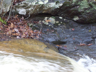
I think I was more intent on the rocks than the graves, though. My wife Valerie found a weathered piece of gneiss containing red-brown lumps that were likely garnets. I almost carried it away with me, but could not bring myself to desecrate a cemetery by removing it. The rock colors were enchanting, though. Valerie captured the soft tones of the rock (justaposed by the green-gray of a shield lichen) in the photograph below:

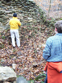
On the way home, I felt the thrill of realizing how many places I still did not know about, and stories I had not yet encountered, in and around the Chattahoochee Hill Country. We passed another unkempt graveyard along Highway 70 -- a few stones among the trees at the side of the road. I imagined projects, perhaps with Montessori school students, of clearing off the stones, doing rubbings, perhaps even researching the people that were buried there....

The Hill Country landscape, full of fragments of memory in metal, stone, and wood, beckons to me, calling me closer.

Monday, January 28, 2008

Prehistory of the Hill Country, Part Two

On the day before our first Sense of Place Workshop Series Saturday outing, to Etowah Indian Mounds State Historic Site and to McIntosh Reserve Park (Carroll County), I noticed with alarm that my little blue square on my computer, to one with the temperature on it, was red and flashing. There was a National Weather Service winter weather advisory for sleet and possibly even snow that evening. Would we be able to take our first trip after all? A much-beloved elder community member had passed away, too, and I received an email from one of the participants, explaining that he had to attend the funeral and would not be able to join us. I awoke the next morning (Saturday, January 26th) to gray skies and a slightly damp but definitely not snowy lawn. The photographer in our group called to cancel, but my wife kindly agreed to join our trip and take the pictures you see here.

My wife and I arrived at Rico Community Center ten minutes late, at 8:40 am. Only two cars were idling there. Two participants from Serenbe, Margaret and Martha, were there in their gray Prius to match my blue one; and Heather, parent of two Montessori elementary students, was also there. She rode with us, and the Prius caravan was on its way. Though small in number, our group made up for it in enthusiasm about the day ahead.

Reaching Etowah an hour and a half later, we were greeted cordially by Ken Akins, site manager, who informed us that he was at our disposal. I told him about the talk Dr. Crass had given us, and he suggested sharing with us a slide show on the most recent site archaeology -- images using magnetometers and ground-penetrating radar to read the traces of walls and structures that had once stood at Etowah. Many of the images, with traces interpreted by Dr. Adam King, chief archaologist on the project, are available online here. Below is a photograph of Ken sharing some images with us from his laptop.

One of the recent additions to the visitor center at Etowah is a model of what the village looked like at its peak, between 900 and 1550 AD:


After watching a video about the Southeastern Indians, viewing the museum exhibits, and watching a slide show on the recent archaeological work, it was time to brave the numbing January cold to explore the mounds themselves. Ken happily agreed to lead us on our walk among the mounds. We crossed the moat, now dry, that once encircled the village, probably for both defense and drainage, then traversed an extensive flat area to a slight rise that marked the edge of the original village plaza. For there, it was only a few steps to the many steps leading to the top of Mound A, the Great Temple Mound: at sixty feet high, it is the second largest prehistoric earthen mound in the country, after Monks' Mound at Cahokia in Illinois. Here are two of our group atop Mound A, looking down on Mound C, a burial mound that was excavated many years ago, and subsequently reconstructed:

Below is our group, with Ken leading us, at the base of Mound B. While the chief had a residence atop Mound A, Mound B was likely inhabited by a sub-chief (the next in line to power).

Finally, we made our way toward the Etowah River. By the river bank, we paused to view a large canoe that has been taking shape over the past couple years, a large tree trunk being hollowed out by fire. Someday, Ken hopes, the boat will take its maiden voyage down the Etowah....

Before returning to our cars and the opportunity for a quick lunch, we paused to gaze upstream, at a fishing weir that remains from the time Etowah was inhabited many hundreds of years ago, though it probably traps more canoes than fish nowadays. Looking at the weir now, I am reminded of a flock of geese, migrating south in the springtime. Or maybe that is just an effect of staying up well past midnight, working on this blog....

The Shape of Feldspar

On the next day following the State Archaeologist's visit, I finally met Dr. Julie Bartley, professor of Geology at the University of West Georgia in Carrollton. Dr. Bartley will be leading the March workshop on Geology in the Hill Country, and was visiting the area to scope out possible outcrops to visit. It was great to get to "talk geology" with someone again, swapping rock types, mineralogical compositions, and geological mapping strategies. After looking over an old and less than reliable geologic map of the area (the only one in print), we settled on exploring at Cochran Mill Park. Three Montessori students joined Dr. Bartley and myself for a ride out to Cochran Mill Nature Center.

Our first stop was right at the entrance to the nature center, where we checked out some enormous granite boulders. Dr. Bartley explained how granites weather into soil, as we scanned the rock face for white feldspar crystals and gray-green lichens (best saved for another day). The photo on the top was taken there; I will save an image of the boulders themselves for our March trip, since this will undoubtedly be one of the places we visit then.

We hiked down the trail from the nature center to the granite outcrops along Bear Creek. On the way, Dr. Bartley showed us how angular the sand grains were along the trail, angular because that is the shape of the feldspar crystals contained in the granite. Then, onto the outcrop (photo on the bottom), scanning the rock for mineral composition, looking at jointing structures (cracks) in the rock, and then searching for a contact with the adjacent rock, a metamorphic gneiss. We found the contact at last, down by the water's edge. The creek flows along the place where the granitic magma intruded into the country rock (no allusions to a former Chatt Hills mayoral candidate intended), a gneiss or perhaps a schist. We found evidence of the other rock type on the other side of the stream, but the water was too fast flowing and deep to allow us to cross. The contact was entirely hands-off. Investigation of those rocks will have to await another day, perhaps a weekend in February, if Dr. Bartley's schedule permits. Considering that the rock is already a few hundred million years old, I suspect it will still be there when we return.

Into the Woods

On the day Dr. Crass visited the Hill Country, he also joined several of the Elementary students at Hill Country Montessori school, for a walk to a nearby farm ruins. The ruins are accessible only by footpath, and are located in the natural area of Serenbe Community. They consist of an old family cemetery (with graves from the mid-to-late 1800s), substantial remains of a farm outbuilding for storing dairy products, and a couple of stone walls from a large bank barn. The farmhouse is long gone, a victim (it is said) of a fire intentionally set back in 1940, so the landowner could avoid paying a "window tax". In the photo above, Dr. Crass is talking with the students about the grave sites (just left of the photo), and what can be learned from them through various archaeological techniques.


The object of our quest, though, was still a few minutes' walk along a wooded hillside, to an ephemeral stream in a gully, where the ruins of the dairy building and bank barn are located. The dairy structure is the more intact, and intriguing, of the two. It had double-thick walls, and two small rooms partially sunk into the ground, with pits in their centers (for keeping milk in cold storage, perhaps?). The rock walls, though moss-covered in many places, are still fairly sturdy, the gabled end wall still prominent. Dr. Crass talked with us about how to date the building: if we were to locate a nail that once might have held the roof together, then we could tell by the kind of nail about when the building was constructed. Late 1800s, most likely.

Dr. Crass was thrilled by our find. Curiosity sparked, he studied the stone walls carefully, as if trying to read in their patterns the story of the building's origins. On our return walk, he wove nets of possibilities for future study of the site, in which an archaeological field program might take up residence there, piecing together the story of the farm, unearthing relics of a dairy operation the first few decades after white settlement (or perhaps occupation is a better word). There is something haunting about a ruins. Crumbling stone walls embody mystery, point to questions difficult to answer, prompt the imagination to fill in the gaps. There is a lot of room for imagining the past, here in the Chattahoochee Hill Country.


Prehistory of the Hill Country, Part One


The Exploring a Sense of Place series got underway on Thursday evening, January 17th. We were joined by Dr. Dave Crass, State Archaeologist for Georgia, who came to Rico Community Center to give a talk on Georgia's prehistory. Arriving a full half hour before the talk began, I was surprised to find three people already waiting at the door! By the time he began his talk, there were sixteen of us.

I had prepared for this presentation by securing a slide screen (visible, folded up, in the photo to the right; Dr. Crass is dressed in dark blue and standing to the right of the screen), a projector, and a laptop. Alas, Dave's thumb drive was newer than my computer, and my computer would not recognize it. We tried another laptop, then finally a third. That one finally worked, but we did not have the right cable to plug it into the computer. So we all gathered around as if at a campfire, while he used the laptop screen to show his images.

Despite this bit of technological frustration, the evening was clearly enjoyed by all. Several participants asked questions about possible local archaeological sites (no documented archaeological studies have been conducted here in the Hill Country). One participant had brought aerial photographs of a large, rectangular mound-like hill, out on the floodplain of the Chattahoochee River. Mysteries abound. Neighbors talk of strange stone piles and stacks, a massive boulder with two deep depressions hollowed out of it (an "Indian mill"?), possible prehistoric mounds. Wonders everywhere. And a question: Can we somehow save them all?

Chorography of the Chattahoochee Hill Country

This blog is a chorography -- from two ancient Greek words, choros, meaning "place", and graphein, "to write". According to Ptolemy (as explained by E.V. Walter in Placeways: A Theory of the Human Envirionment), while the geographer studies the earth as a whole, the chorographer explores a small part of the earth, examining it meticulously, reading it deeply, and crafting maps from that study. What results is a "deep map" (as William Least Heat Moon would call it), a "bioregional vision" (in the words of Kirkpatrick Sale), or perhaps, more simply, "a sense of place". This blog is a fragment of my own quest for a sense of place, here at the crossroads of Goodes, City of Chattahoochee Hill Country, Palmetto Post Office, Southwest Fulton County, in the upper Piedmont Province of Georgia.

The latest steps in my journey have been taken in the company of others living nearby, participants in a year-long series of evening talks and weekend outings into the surrounding region. The workshop series is entitled, "Exploring a Sense of Place: The Chattahoochee Hill Country", and is inspired by a similar annual series of workshops in the San Francisco Bay area. Here in the Hill Country, our workshop series has been developed and organized, and is currently being administered, through the Southeast Institute of Place-Based Education, of which I am the Director. The Institute, in turn, is part of Hill Country Montessori School, also at the crossroads of Goodes, Georgia. Our series has been sponsored by The Serenbe Institute, which is part of Serenbe Community, a sustainable, environmentally conscious newly-designed settlement here in the Chattahoochee Hill Country.

The goals and general format of our workshop series are detailed at the institute's website, http://www.southeastpbe.org/. The vital concept is this: that learning about a place -- in the sense of a deep learning, one that recognizes the role of the senses and the emotions, one that is not limited to facts out of history books, one that is alive, participating in the oral tradition, immersed in story -- this kind of learning is a step toward caring, wonder, community, sense of place. The result is a deeper bond with where we live, a deeper concern for the fate of the land, our home place. There are many ways to come to know our places -- far too many for a single year to embrace them all. This first year of the workshop series, we are exploring the region's prehistory, Civil War history, geology, art, gardens, botany, lichenology, herpetology, ornithology, entomology, agriculture, rivers and creeks, ecology. Together, the participants in these workshops will learn new stories at the same time as we write our own together, through the journeys we will share, and the experts and elders who will guide us along the way.

This blog will serve as a record of that journey.