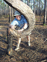
We piled back into the min-vans, and headed east down the South Fulton Parkway, toward Cochran Mill Rd. The drive lasted only a couple of miles, but it was time enough to recover somewhat from the harsh wind and cold of the rather wintery late Saturday morning. By the time we parked the vehicles and crossed the road, the sky had clouded up, and a few flurries were falling, and it felt colder than ever. We paused in front of the outrcop again, to try to make sense of it all, in word or gesture (above).
 Julie quickly discovered another possible Contact, and this one was much more intriguing. Below was the old standby, Palmetto Granite, with its phenocrysts (large crystals) of feldspar. Above, a series of layers, black and white and intermixed -- a melange of metamorphic material. It was beautiful, and fascinating. It was a Contact where much had happened. The surrounding rock had already been metamorphosed from gosh-knows-what parent rock (shall we take it for granite?), into a well-foliated (layered with minerals) gneiss. Then the granite intruded the gneiss, most likely during the uplift of the Appalachian Mountains, roughly 350 million years ago. The process was an example of regional metamorphism, because it involved the deformation and transformation of rock over a large area, as the result of tectonic forces. The hot magma "baked" the zone where it met the gneiss, causing contact metamorphism, a kind that is localized and usually the result of a magma coming into contact with much colder rock. It was a sort of geological epiphany, to see a metamorphic rock that had, in turn, been metamorphosed again, but in a very different way.
I felt like a college student, back on an introductory geology field trip, getting my eyes opened and seeing rock units in more profound ways than before. It was the kind of experience that is all too rare in book reading (for all the books that I polish off every year) -- a deep knowing that comes from direct encounter, from the experience of witnessing the outcrop and feeling amazement at the story it is telling. This is why geology needs to be taught as a field science, not something that can be learned through "virtual field trips" and computer simulations. What is actually going on out there is much more powerful than what one simply reads about. Maybe T.S. Eliot was right: "Human kind cannot bear very much reality." That discovery, that metamorphosed rock could also be metamorphosed through contact with granitic magma, lingered with me throughout the remainder of the trip, and stays with me now as I type these words. I still recall fondly that moment of enchantment and bliss, there in the bitter wind on that second outcrop of the day, gazing at the Contact and into its secrets.


 In her carefully prepared talk (broken into sections by time participants spent examining the rock samples), Julie explained to us how the Piedmont is the most complex part of Georgia to interpret geologically. Here, we are in the middle of the Piedmont, far removed from the generally level, younger sediments of the Coastal Plain. Instead, underlying the Hill Country are metamorphic rocks, some deformed several times during various plate tectonic events, intruded by igneous rocks, some of which have themselves been deformed, perhaps even shortly after being emplaced. The result is, well, a mess. And it is a mess that very few people seem to want to tackle. Even Julie prefers to study, in her own fieldwork, Precambrian carbonate reef structures (in such places as Morocco and Siberia). Julie explained that much remains uncertain about Piedmont geology; a new digital geologic map of the Atlanta metro region was recently released, but doubts have already been raised about its accuracy.
 We all had a lot of fun, though, just appreciating the complexity of the story, and not worrying too much about the details. Our challenges were, first, to identify which rocks belonged to which of the three major physiographic regions of Georgia: Coastal Plain, Piedmont & Valley and Ridge, and the Blue Ridge. Later in the evening, we worked on a number of black and white rocks, some foliated (schists and gneisses), others not (granites). Wordplay possibilities abounded throughout the evening; at several points, I was sorely tempted to make a remark about not taking everything for granite -- a pun that is rather cliche, I suppose, but is nonetheless tempting to share with novice geologists.


 We took our time on this, our last Palmetto Civil War history stop in the middle of a Saturday afternoon. Wandering among the stones, we glimpsed other stories. The graveyard also holds the remains of Hannah Penn, who died in the late 1700s. She was a descendant of William Penn, founder of Pennsylvania; a branch of the family came south, to the Palmetto-Newnan area, eventually marrying into the Johnson family. A displaced Pennsylvanian myself, I paused togratefully recognize the others before me who have uprooted themselves from the Keystone State, to make a new home in the wilds of Georgia.
 The above photograph is of the law office of Jim Barfield in Palmetto, formerly the Stagecoach Inn, circa 1831. Jim proudly notes on his website (
 But all that was last month -- ancient history. This month is all about how Palmetto became contested terrain a second time, as the Union and Confederacy vied for victory. No major battles were fought here, but the former train station (the one before the one standing there now) was burned by McCook's Federal cavalry, who also tore up and burned the railroad tracks over a two-mile stretch in Palmetto in late June of 1864. Of course, the story of the sacking of the town and destruction of its rail line, connecting Atlanta with Columbus, is a tale told in the absence of evidence, since everywhere was "a scene of fire, of ruin, and devastation" (as quoted in Sherman's Horsemen by David Evans (Bloomington: Indiana University Press, p. 227). So Keith pointed to the current railroad underpasses (the arches with crumbling white plaster) and remarked that the raiders had burned the previous wooden trestles that once stood there, along with the town's original buildings (now gone) and the original rail line (since replaced). All that remains is an anachronistic cannon, like some sort of lawn ornament, a roadside plaque, and local stories.


 Our path continued along the stream a short distance, then up the ravine, following the route that Hazen's Brigade of Federal infantry had taken, all the while being fired at from the top of the ravine by dismounted Confederate cavalry. We walked along the edge of a field, which had been planted in wheat at the time of the battle. A terrible place to get caught in crossfire -- sometimes it is not so wonderful to be out standing in one's field.
 Continuing upslope, we came to a place where a pair of low ridges with a narrow gully between could be seen under a blanket of oak leaves. Amazingly enough, these earthworks were dug hastily by the federal troops positioned there when the battle began. Over 140 years ago now, yet the land remembers. Could there be a finer monument to the fallen dead than these gentle furrows in the ground?