Here is the second of our two Cochran Mill Quests, created by middle school students at Hill Country Montessori. To my knowledge, these are the first Quests to have been created in Georgia! You can read more about Questing at http://www.vitalcommunities.org/ValleyQuest/ValleyQuest.htm. Check out the list of Online Quests for other ones in the United States. Both of these quests will be submitted for inclusion in their list.
Against the Grain
Cochran Mill Park Quest #2
To complete this quest, a field guide to trees might be helpful. Park along the south side of Cochran Mill Road, about a thousand feet southwest of the entrance to Cochran Mill Nature Center, directly opposite the ruins of a brick chimney in a fenced yard. Follow the trail over a rope barrier (now lying on the ground). After walking a few feet, turn right to parallel Cochran Mill Road. You are now on the trace of the original roadway.
Follow the old road, continuing to be alongside the present-day one, until you see a dip in the trail. On your left, on the wooded hillside, are terraces that farmers used for growing cotton here. They are probably from the early 1900’s.
Come to where the road cuts through some rock. Lichens and algae cover the rock in many different colors. The brightest color is __ __ __ __ c __.
Continue down the path to a big fat tree on your right, just beside the path. It is probably over 100 years old. It is a __ __ c __ __ __ __ __.
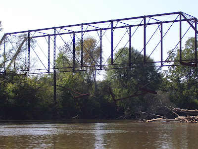
The bridge that you come to crosses Bear Creek. Cross the bridge and take the path to the right. You are still on the original Cochran Mill Rd. route.
The road soon turns completely to gravel. On the right is a star-shaped stump, and behind the stump is a big rock. The rock has long s __ c __ __ __ h marks on it. What do you think these are from?
Continue down the former Cochran Mill Rd. On your right is the forested floodplain of Little Bear Creek. Continue straight down the path until you come to a bridge. The bridge is unusable because of its age. It is also part of the original trace of Cochran Mill Rd. Just beyond the bridge are the ruins of an old mill, from the late 1800’s. It is the oldest mill in the park. The only things left of the mill are a few stone walls. Standing where the mill used to be, if you face the falls, you will see a path to your left, going up the hill along the stream edge. It goes over a rock to start, and may be hard to see. Not far up the path is a rusted metal __ c __ __.
Continue up the hill if you want to see the mill dam, mostly destroyed by vandals in the 1970’s. When you come back down the path and back to the mill site, look to your right. Hidden by vines are a couple more mill walls.
When you are done looking at the mill, start to go back along the trace of former Cochran Mill Rd., the way you came. You will see a path going uphill to the right. At that fork, look right. There is a __ __ c __ __ __ __ c.
On the left after a hundred feet or so, you will see a cleared area. You are on the driveway of an old house. Can you find the concrete pad, hidden under the leaves, where the garage probably was? Can you trace any of the outlines of the now-demolished house? All that is left are some bricks and some sheets of metal. The house is from the early 1900’s. The mill owner probably lived there.
Follow the steps up the steep hill. At the top is a bench, where you can stop and rest. Follow the main path down the hill. Don’t slip. When you reach the Bear Creek again, go left. A __ __ c __ __ __-down tree makes a great bridge for squirrels to cross Little Bear Creek. When you come to a sign (in concrete, but not stuck in the ground) go left onto Loop Trail A.
When you come to another fork, go left again. Look around while you walk. After a while, on either side of the path you will see piles of rocks in a rough line crossing the trail. This is likely the remains of a stone __ __ __ c.
Down the path a little further is a clump of Christmas __ __ __ __ c. Their name is easy to remember, because they have leaflets that look like Santa’s boots. On the right are some more old farm terraces.
When you come to a sign that says “Trail,” turn right and hike up the hill, along a path lined with rocks. Continue on this path until it goes downhill. Once you pass a bench and a plank bridge, take a side trail to the left. As the trail approaches Bear Creek and starts heading back up the hill, you will see a stone wall on the left, near the stream edge. Turn left on a small path to go to the ruins of small building, constructed in 1906. Water flowed over a turbine here, making electricity for the city of Palmetto in the early 1900’s. Look for a gap in the wall that holds the box with the final clue in it. Watch out for the hairy vines and three-part leaves of poison ivy, which covers some of the walls.
Take the letters in the boxes from the answers above and rearrange them to find the answer to this question:
What was the oldest building in Cochran Mill Park used for?
It was a __ __ __ __ __ __ __ __ __.
When you have found the red box, answered the final clue, and stamped your Quest book, go back down the trail the way you came, all the way to the “Trail” sign. Don’t turn left! Instead, continue straight ahead along Bear Creek, until you see the footbridge across the creek. Turn right, cross the bridge, and follow the trace of former Cochran Mill Road back to your car.
Tuesday, November 18, 2008
Questing at Cochran Mill, Part One: A Shocking Conclusion
Hill Country Montessori Middle School students recently collaborated to create two Quests at a nearby nature center and park. (For the location of the nature center and information about its programs, visit it online at http://www.cochranmillnaturecenter.org/.) Taken together, the two Quests reveal the rich history of the Bear and Little Bear Creeks in Cochran Mill Park. The park property was the site of a couple of 19th Century grist mills, as well as an electricity generating station in the early 1900's. We based our Quest on a survey of historical structures in the Park (one that appears to exist only as a single copy in the office of the state archaeologist), along with an essay in "Early Georgia" (a periodical published by the Society for Georgia Archaeology at http://www.thesga.org/) about the technology behind Cochran Park's mills and dams.
Sadly, most of the structures in the park were severely vandalized in the 1970s and 1980s. Two mills were burned by arsonist's flames, while a more recent picnic area was utterly demolished (with one picnic table currently underwater at the base of the largest waterfall in the park). I am disappointed that such a lovely place, with such rich historical significance, can have been mistreated to such an extent. Even the trail signs have been damaged. Several are missing altogether, while others have graffiti on them or have been pulled up out of the ground. Graffiti used to cover the underside of the supports to a pedestrian bridge across Bear Creek; our school scrubbed away some of it, but ghost images of the older paint still remain. I am baffled that such a rural and rather remote location has been visited by such damage. Visiting the park, I begin to wonder about the value of place-based education. If greater awareness of local "treasures" (historical or ecological) means greater visitation, doesn't that increase the likelihood, in turn, that vandalism would occur? Are fragile landscapes best left unknown and relatively hidden, or protected by park signs that are easy to ignore?
With those thoughts in mind, here is the text of the first of our two Quests:
A Shocking Conclusion
Cochran Mill Park Quest #1
To complete this Quest, a field guide to trees might be helpful. Park in the Cochran Mill Nature Center parking lot. To get to the trailhead for this quest, walk back down the gravel entry road along the edge of the pond. Turn left and walk downhill to a trail sign. Take the wide, flat trail straight ahead of you, now known as The Waterfall Trail. This path used to be the access road to the mills along Bear Creek, whose ruins you will visit during this quest.
As you walk down the straight trail, you will notice a pile of rocks a short distance off to the right. __ __ __ __ c __ covers many of the rocks.
Continue on the path until it curves to the left. At the bend, you will see a large fallen pine tree that has been partially cut into logs. It is the same kind of pine that commonly grows in this part of Georgia, including along this trail. What kind of pine is it? __ __ __ c __ __ __ y.
Continue for about ten minutes along the trail, passing a small rock outcrop on the left. You will come to a place where the trail leads out onto bare rock. What kind of rock is it? You can take it for __ __ __ __ __ __ c.
Follow the sound of flowing water to the remains of a large dam. You will walk past an area on the right where we did some privet removal a year ago. The privet is already on its way back, though. You will see several small evergreen trees growing among the privet. What kind of tree are they? c __ d __ c s.
Stand at the stream edge, facing the broken part of the dam where the water flows over the edge of the wall. (The dam was originally constructed sometime in the 1930s; vandals broke the dam in the early 1970s.) Notice that, when viewed from downstream, the dam face has a series of steps. In side view through the gap in the dam where the water flows, you can see that the widest part of the dam is toward the bottom, and the narrowest part is toward the top. Why do you think the dam was built that way? After pondering this, turn away from the dam and face the woods. You will see a brown trash barrel. Take the narrow trail toward it. Near the barrel, along a wide path, you will see a large tree. Look around on the ground for its leaves, which have rounded lobes to them. What kind of tree is it? __ h __ c __ __ __ __.
Take the wide trail upstream until you come to a fork in the road. Look to your left, and you will see some ruins of an old house. It was built in the first decade of the 20th century, for the mill operator and later, the resident caretaker of the property.
Continue straight up the path for several hundred feet. Be watching on your left for the ruins of a small concrete structure that once had a flat wooden top to it. What do you think that it was? A __ __ c __ __ __ __ __ __ __ __. A group of bikers, the story goes, vandalized this part of the park in the 1980s.
Continue on the trail upstream until you arrive at a second large rock outcrop that the trail crosses. Look right, and you will see the ruins of a former mill, originally constructed by Barry Cochran in the late 1800s for the grinding of grain. A wood-framed building, it was destroyed by a fire set by vandals in 1972. Amid the ruins is a large wheel made of rock that was a very important part of the mill operation. What is it? A __ c __ __ __ __ __ __ __.
Between the ruins and the stream is a very weedy area; however, if you feel adventurous, walk toward the stream edge, and you will find the water wheel support foundations. Look out across the stream. Until the dam upstream was broken in the 1970s, that area was a pond. Hiram Evans, who owned the park property in the 1940’s, had the lower dam constructed to create this pond, but it was never used to power a mill. Instead, Evans had a building on stilts constructed in the middle of the pond, with a causeway accessing it that ran from the mill building out into the pond. Locally known as “the fortress”, this building had a checkered history. Hiram Evans was the Imperial Wizard of the Ku Klux Klan; supposedly, he used the building for secret Klan gatherings. Later on, in the 1960s, parties were held there. The house burned down in 1972, in the same fire that destroyed the mill.
Continue on the trail upstream to another dam. Along the way, you will notice several concrete structures sticking out of the rock. The larger, low ones were foundations for utility poles; the tall, narrow ones closer to the dam were pylons for a penstock that carried water from the upper millpond down to a structure you will see later on this Quest. The dam itself dates to the mid-to-late 1800s, and is built of local stones without mortar. Sections of it were replaced by volunteers in the late 1970s. There is a pipe sticking out of the dam. How many layers of stone can you count above the pipe? __ __ __ __ c.
Turn around and start back down the wide trail downstream. You will arrive at a fork in the path, with a large pine tree straight ahead. Take the left fork. Once you reach the rock face, go slightly left, and follow a path leading down to Bear Creek, past several clumps of star moss. The trail continues along the stream edge. Look across the stream, and you will see a small rock-and-cement structure. This building was a generator house, constructed in 1906. Stand at the edge of the stream in a location directly opposite from the near corner of that structure. There should be two slender trees near the stream bank that make a “doorway” through which you can view the generator house. Turn around and walk away from the stream edge. Walk until you cross a gully/path, counting the number of steps it takes you to get there. Round that number of steps to the nearest ten, and write it here: __ __ __ __ c.
Continue to walk in the direction you were going when you reached the path/gully, taking about the same number of steps that you wrote above. Look for a box with the stamp pad and book for this Quest.
Finally, arrange the letters inside the boxes in each answer above, to find the answer to this question: "The generator house is the newest structure along one of the streams in Cochran Mill Park. From 1906 until 1918, it was used to produce something for the City of Palmetto. What did the generator house make?"
__ __ __ __ __ __ __ __ __ __ __.
Tuesday, October 21, 2008
Canoeing the Chattahoochee
 On the lovely but brisk autumn morning of Saturday, October 18th, fourteen of us set out down the Chattahoochee River, from near the South Fulton Parkway Bridge southwest down to the Whitesburg Bridge. Amongst our group was Dr. Christopher Tabit, aquatic ecologist from the University of West Georgia (http://www.westga.edu/~biology/faculty/Tabit.html), and Steve Lawrence, scientist with the US and director of the Chattahoochee River BacteriAlert program (http://ga2.er.usgs.gov/bacteria/default.cfm). Both scientists had regaled our group with background on water quality issues along the Chattahoochee in a previous evening presentation, on Thursday, October 9th.
My plans for the day had been shaped by an earlier run down the river. Ben Simms (outing leader) and I had completed a scouting run on a warmer but windier day a couple of weeks earlier. It had not rained in ages, and the river was quite low, with abundant rocks lurking in the shoals. We made it through without incident, though for a considerable portion of the trip we faced headwinds great enough to turn my canoe and almost push me back upstream through a stretch of rapids. It took us five hours to run the approximately ten miles. Ben, accomplished river runner, glimpsed all sorts of wildlife, including an otter; I contented myself with several great blue herons (or was it the same heron that we kept chasing downstream?).
Anyway, Saturday's run was different. It had rained all day the previous day, and the river had risen over a foot from our earlier trip. The wind had abated, and we raced downstream with very little effort. The few morning clouds quickly lifted, and the sun shone brilliantly in a clear blue sky.


We zipped downstream, quickly (and unknowingly) passing the spot where we had planned to pull out for lunch. We were so early in the day that it had not yet been flagged for us -- we later calculated that the flagging must have been put up within five or ten minutes of our passage. Meanwhile, I kept my canoe as close to the Fulton County bank as I could -- balancing that against my wife Valerie's requests from the front of the canoe that we keep to the sunnier middle of the river. As we glided along, we passed by a dramatic example of bank collapse, in which a huge chunk of riverbank, trees and all, had sluffed off into the river. It made me think of our current economic woes and other failing banks....
 Eventually I came to the unavoidable conclusion that we had missed our lunch stop, though it was scarcely eleven in the morning at that point. I also realized that I had neglected to bring the cell phone number of the person who had generously offered to provide lunch at his own land along the river. I remembered, though, that the cell phone number was in an email; but how to access my Hotmail account midstream? I called my in-laws in Westchester, New York, figuring they would probably be inside at the computer. While my father-in-law went online and looked for the right post, my mother-in-law chatted with me, remarking that she did not think she had ever spoken on the telephone with someone in a canoe before. Finally, my father-in-law located the number and relieved, I dialed it quickly. It rang and rang. What to do?
 Meanwhile, the moments raced by, and we arrived at the first bridge. The old Whitesburg bridge had been closed, and local residents had robbed the bridge of much of its material. The remaining I-beams were in various states of disrepair. Several of them dangled midair above the river, warranting the alternative name of "eye-beams". We kept to the other side of the central concrete pylon. I paused the canoe while Valerie photographed the dilapidated bridge, which evoked a massive modern art sculpture by its size and the precariousness of its dangling steel beams.

 Shortly before noon, we arrived at the pull-out point alongside the Whitesburg Bridge. We took out the canoes, then drove in caravan to the access road to the spot where we were going to have lunch. In 4-wheel-drive vehicles, we travelled a series of rutted jeep trails to the stream edge, where tables draped with white tablecloths awaited us. Our host, who had recently turned his cell phone on and received my message, was elated to see our group. We had a marvelous and very filling meal of sandwiches and potato salad and chocolate-chip cookies. Afterwards, we strolled the cleared riverbank, admiring the view.
Wednesday, September 24, 2008
Reading the Hill Country's Agricultural Landscape, Part Two
 Our Saturday outing this month was held on September 20th, two days after I spoke at The Studio at Serenbe about reading the local landscape. After pointing out remnants of past agriculture in the area in my talk, the obvious next step was to take a trip to see current-day farm projects in the Hill Country. We visited two farms: Serenbe Farms (http://www.serenbefarms.com/) and Wayne Stradling's cattle operation and orchard. We began our morning at Serenbe Farms, an organic CSA farm (to which I happen to belong, I freely and joyfully admit) managed by Paige Witherington. Paige led the five of us on a tour of her farm, sharing stories of her own background, tales of the challenge of farming the red Georgia clay, and a variety of her experiences with various vegetables. (Okra and basil are easy, eggplant is abundant no matter how few the farm has grown, and winter squash have been particularly difficult lately.) Farming is an art of balancing dozens of variables at several scales, from market demand and interest (yes to red peppers, no to gladiola bouquets) to soil chemistry parameters. At one point, she showed us a patch of fallow ground between a farm plot on one side and the Hill Country Montessori Herb Garden on the other. She explained that they will probably never grow vegetables there (unless in raised beds) because there had previously been a house on that site, and the soil was very poor. The land remembers, holding onto traces of the past that shape its present use.
 After regaling us with memories of her days in the oh-so-fertile flat fields of the Hudson River Valley, and taking us past her farm machinery collection, including her pride and joy John Deere tractor, she led us into her new greenhouse (to the left in the photo above). It felt so spacious after the humble accomodations her former (and now unused) small greenhouse had afforded. Then we followed the main farm road uphill, past the HCM Herb Garden (the brick structure just right of the farm road in the photograph above), to a sequence of garden beds, each with their own stories -- pasts of failure and success, futures carefully scripted (a mix of different families of plants from year to year, with many fallow spaces in-between). The farm has bee hives, egg-laying chickens, and dozens of varieties of vegetables -- including three kinds of okra! I took the photograph below of one of the okra plants in bloom, a promise (or, after several weeks of okra, perhaps more of a veiled threat) of okra-yet-to-be. The plant is lovely -- a southern belle (bell?). But I cannot eat the pods fast enough. This week, Leonard Presberg offerd me his share of the okra harvest for the week -- a half pound. I am thankful, yes, but also looking forward to a weekend trip to Delaware, and four days without okra!
 We all had a marvelous hour learning from Paige. I most appreciate her enthusiasm for learning new things, and her recognition that each year and each field and even each plant will express itself in ways that differ from others around it. We stopped, for instance, at a couple of rows of hops Paige is working on trying to grow for an Atlanta microbrewery. There, she pointed out how most of the plants are doing poorly, yet one variety of hops has overgrown its trellis and is climbing a trellis pole toward the sky.
 After an hour with Paige, we took off down Hutcheson Ferry Rd. toward Palmetto, to tour Wayne Stradling's retirement estate, complete with lots and lots of cattle and old apple and peach trees. He met us with his shuttle arrangements above -- tractor pulling trailer with wooden boards for seats -- assuming that I was bringing a group of children. But the five of us were "young at heart", as the cliche goes, and we had a grand time on a sort of a hayride, up paths and through uncleared meadows. Wayne told of his farming experiences, as his tractor roared along and exhaust fumes filled the air. He talked about trying to obtain more water during the drought, and about which kinds of grass are best.
  After talking with us, Wayne proudly showed us some of his cattle, including the two specimens below. He shared some groundfall Granny Smith apples with the herd, but they were rather reluctant to oblige with a show of devouring them. They sure were cute, though, particularly the young calves! At the same time, I will admit that, throughout my visit, I kept thinking of the forbidden pleasures of organic hamburgers.

At last, as we bumped along the road (of sorts), I reflected upon how the wonders of the Hill Country's rural landscape become particuarly noteworthy when one gets off the roadways. Then, for instance, I can feel renewed amazement for being able to experience such bucolic farm scenes as the one below (looking past a pasture oak and toward Wayne's farmstand off Hutcheson Ferry Rd.), yet live only a dozen miles from the City of Atlanta.
 At last, the Stradling Shuttle delivered us back to where our cars were parked. Toward the end of our trip, Wayne admitted that he farms because he loves doing so (not for the money, because his operation just breaks even -- yet he keeps his hundred head of cattle on over a thousand acres, most of which are owned by neighbors). He continues to add acreage to his cattle operation, despite being currently 77 years old! I commented to him that many people his age have opted for retirement villas and golf instead of an active farm life, and he responded that he knew several friends who did that, and they are all dead now. I was very much amazed to find he was that many years old, since I had always assumed he was 65, at most. Maybe when I retire, I'll keep cattle, too....
Tuesday, September 23, 2008
Reading the Hill Country's Agricultural Landscape, Part One
 I inhabit a landscape of loss. I recall Shelby Foote, writer and historian of the Civil War, remarking (on Ken Burns' Civil War program) that the South is unusual in the country because it has had the experience of losing a war. But that is not all that it has lost. It has also lost the A horizon of its soil -- a layer of organic-rich "topsoil". Up to a foot of black earth once covered its red clay heart, the now-exposed iron- and clay-rich B horizon. All that is gone -- lost to King Cotton, and afterwards, lost to mismanagement as fields were abandoned during the Great Depression. Maybe, in a few thousand years, a new A horizon will develop. But for now, I am haunted by the sense of absence, an incomplete soil. And all around me, inscribed into the landscape, the gullies that once flowed with a slurry of soil and water, and the upland terraces where the cotton once grew. Looking closer, I see old fencelines with barbed wire, and Coca-Cola bottles from the 1920s (I discovered two across the road from my house), and rusting farm machinery of mysterious form and purpose. And I think about what once grew here, and the cattle that once roamed fields now grown to forests (and still roam other nearby fields).
Mostly, though, I think about the soil. There is a new soil survey for Fulton County -- 2008 -- and and older one (and more intriguing, for its age), from 1958. The soil names have all been changed in the interim, and the aerial photograph used as a base is correspondingly newer, too.
Nonetheless, my favorite local aerial photograph is the one above. It shows the crossroads of Goodes, southwest Fulton County, as it appeared from an airplane sometime in 1938 -- back when a lot of the erosion was still going on, when the topsoil was still on the move. Goodes is more noticeable on an aerial photograph or map than it is from the ground -- the roads come together in a distinctive pattern that lends character to what otherwise would be just any other highway intersection in what passes for "country" outside Atlanta. From the ground, Goodes is just a sign like an old-time gas station kind, easily overlooked.
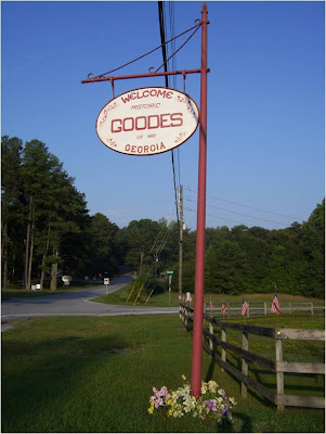 But in the aerial photograph, I can spot Goodes among dozens of other highway crossroads. Rico residents may have the old schoolhouse that is now City Hall, Police Station, Community Center, and Library all rolled into one (and they may have the volunteer firehouse, too), but we have that strange crossing of roads where the north-south Atlanta Newnan Road is offset, with Rico angling northwest in-between its two sections. A geologist, examining the crossroads, would declare Hutcheson Ferry Road a fault line, and pronounce the movement right lateral.
Hutcheson Ferry is hardly a plate tectonic boundary -- we are fully in the United States, deep in the heartland, as the soundly Republican tone to the political signs on homeowners' lawns remindes me. But it is a boundary of another sort -- a drainage divide, separating small subbasins within the Chattahoochee River Watershed. To the north, along Rico Road and in the woods just across the street from my house, a brook flows in a narrow but deeply-incised channel, eventually joining another stream, flowing into Longino Creek and then at last into White Oak Creek, and thence into the Chattahoochee River. To the south, the water flows into ephemeral gullies, like the one behind Hill Country Montessori School, and then into Cedar Creek, which briefly serves as county line between Fulton and Coweta Counties.
All this shows that, if not the center of the universe, Goodes is a fascinating place to be. But, as Brian Swimme the theoretical cosmologist reminds us (to go from the crossroads to the cosmic for a moment), we are in an expanding universe where every point is a center of expansion. So every place is the center of the universe. Goodes is as good an axis mundi as any other one, and perhaps a bit more distinctive when viewed from above (or nowadays, from Google Earth). But other spots are intriguing in their own way, if you slow down enough to read them -- to study their chorography. That, I suppose, is the irony of being a proponent of reading the landscape -- I become proficient at reading stories in the immediate earth where I live, but I do so with the hope of encouraging others to do the same in their own places.
The stories are different, perhaps, though too many are, I fear, variations on a theme of loss. After all, no places on this continent will feel again the whirlwind force of a visit by a sky-darkening flock of passenger pigeons, and no tree will shake with the tropical chatterings of a flock of Carolina parakeets. The elm tree is gone, apart from a large specimen I found along a trail at Etowah State Historic Site. And the chestnut is gone, too, apart from a few tentative saplings that die young and diseased (awaiting a naturalist equivalent of A. E. Housman to celebrate them), and a dozen that made National Public Radio news last year for lingering into adulthood on the slopes of Pine Mountain, well south of here.
I was the speaker in our Sense of Place Series this month, though I did not cover anything I wrote above (except the lost topsoil part). I drew upon the work of an ecologist at the University of West Georgia, Joe Hendricks, presenting one of his Terrestrial Ecology PowerPoint presentations to offer the half-dozen audience members a sense of the landscape history of this region. Then I showed the Goodes aerial photograph from 1938 -- a travel back in time to when terraces were still bare -- covering parts of the land with patterns akin to suminagashi, the inky swirls of Japanese marbled paper. Then I showed them images from a walk in the woods I took last year, with scenes evoking stories in the landscape.
Above is what I wanted to say, or begin to say, or struggle to make sense of -- the mysterious force that compels me to find new stories in the land, the way I have become so taken with the crossing of roads I walk every day, the way I thrill to the discovery of another trace of abandoned fenceline, the sorrow I feel when I look across a gully at a white oak over a hundred years old, once a pasture tree and now, roots exposed, holding for life onto a mound of soil. And I think of the distance between that oak and me, a distance once filled with earth, now not capable of being bridged. It is a distance in space, of course, but also in time, back to a time when the soil was black not red, and the forests were composed of oak and hickory, not these weeds of loblolly and sweetgum I now find cropping up wherever I leave the lawn unmowed. We cannot go back -- Georgia will never again be the wilderness that William Bartram explored, or where, centuries earlier, Hernando DeSoto first encountered the remnants of the Mississippian civilizations (once called "The Moundbuilders"). The gullies are largely stable now, except perhaps after a heavy rainstorm. Then, briefly, the water may trace out with muddy fingers the gullies' former paths, leaving behind a thin blanket of silt in its passage over pine needles and sweetgum leaves and branches and bare earth.
Sunday, August 24, 2008
Birds and Butterflies of the Chattahoochee Hill Country: Part Two
On Saturday, August 16th, a group of us met at Hill Country Montessori School for our monthly Sense of Place Outing. We were bleary-eyed and clutching cups of coffee, because it was only 7 in the morning. (Ironically, the early start time was intended so that we would enhance the likelihood of seeing a variety of birds. Yet, apart from a brief glimpse of a couple of great crested flycatchers (Tara identified them -- I saw only a blur of movement.), we saw practically no birds during the entire outing. We heard quite a few, including a number of catbirds, and we also briefly glimpsed a ruby-throated hummingbird sipping nectar from a flower on the other side of Cedar Creek. But otherwise, our trip would be a trove of insects. Tara's consolation prize, though, was a number of insects that took rides on her shirt throughout the morning, including a dragonfly that stayed with her for an hour, and a butterfly that landed on her shoulder toward the end of the morning.)
We caravanned to Dunaway Gardens just south of the Fulton County Line in Coweta County, where the gate was opened for our entourage to enter. The gardens, otherwise closed for the weekend, were opened just for our group. Throughout our visit, we relished the experience of being on our own in the gardens, in contrast to our visit earlier this year, when our trip coincided with several large garden tours and an afternoon wedding. Garden maps in hand, we hurried downslope to the edge of Cedar Creek. Although the path was well-mowed, my feet were still quickly drenched by the early morning dew.
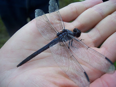
Gosh, did we see a lot of insects, though! Greg, sporting an insect net, was full of glee, snatching up all sorts of treasures in his net. It was still cool enough in the early morning that the dragonflies were motionless atop plant stems, and an easy catch. The first one we found, a slaty skimmer, is pictured below. This is the dragonfly that subsequently befriended Tara for much of our morning.
We caravanned to Dunaway Gardens just south of the Fulton County Line in Coweta County, where the gate was opened for our entourage to enter. The gardens, otherwise closed for the weekend, were opened just for our group. Throughout our visit, we relished the experience of being on our own in the gardens, in contrast to our visit earlier this year, when our trip coincided with several large garden tours and an afternoon wedding. Garden maps in hand, we hurried downslope to the edge of Cedar Creek. Although the path was well-mowed, my feet were still quickly drenched by the early morning dew.
Gosh, did we see a lot of insects, though! Greg, sporting an insect net, was full of glee, snatching up all sorts of treasures in his net. It was still cool enough in the early morning that the dragonflies were motionless atop plant stems, and an easy catch. The first one we found, a slaty skimmer, is pictured below. This is the dragonfly that subsequently befriended Tara for much of our morning.

 A few minutes later, Greg was using his net to try to catch some aquatic denizens of a small pond adjacent to the creek. He quickly found a water scorpion -- an insect belonging to the order Hempitera, or the "true bugs". Related to the terrestrial "walking stick" insect, water scorpions are air-breathing predators that feed on smaller insects, such as mayfly and stonefly nymphs.
  In another few minutes, Greg had located a "tent" belonging to a cluster of tent caterpillars in a shrub along the streambank. Based upon their size, the larvae appeared to be almost ready to pupate, emerging afterwards as small, reddish-brown moths.
 Continuing along the riverbank, we saw another dragonfly, perched calmly on a blade of grass. I snapped its photo before it flew away.
  We continued along the creek's edge, stopping to scan the far bank for birds, but to no avail.
  The prize find of the day, in my opinion, was a sleek green tree frog that I noticed on a cattail reed, blending in almost perfectly with the stalk. A moment later, a green dragonfly (possibly a pond hawk) landed on a nearby reed and perched there for a group photo.
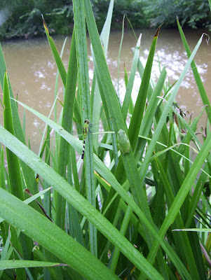
I returned to the site a few minutes later, and the dragonfly had flown away. I did get a splendid closeup of the green tree frog, though, who remained motionless there, against the backdrop of Cedar Creek.
 At last we wended our way up through the gardens, finding quite a few butterflies but only a couple of birds. We heard a woodpecker's call through the trees, and briefly saw a cardinal who scolded us from a shrub along the path. Tara, Greg, Valerie and I inspected another set of shallow ponds (Arrowhead Pools) that had been constructed as part of the gardens. Tara found an intact snakeskin in the shallows, but the birds (including a heron known to haunt the area, feeding on the pond's goldfish stock) continued to elude us.
Chattahoochee Hill Country Birds and Butterflies: Part One
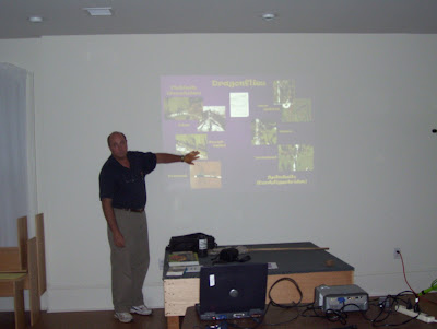
On Thursday, August 7th, eight participants joined us for overviews of the birds and winged insects (butterflies and dragonflies/damselflies) of the Chattahoochee Hill Country area. Tara Mostowy, biology graduate student at the University of West Georgia, began with a splendid overview of bird identification. She then shared with us both photographs and brief descriptions of the range of local birds we might see on our trip to Cedar Creek wetlands, later in August.
 After her talk, Dr. Greg Payne, entomologist at the University of West Georgia, walked us through an array of butterflies and dragonflies. In a marvelous conjunction of terms, our entomologist speaker also regaled us with extensive etymological information about the origins of many of the complicated terms used for classifying insects.
Not visible in the photograph above, off to the right, was a row of tables full of fascinating bits of natural history. Greg brought in wood and glass boxes full of mounted insect specimens, several dissecting microscopes, and a number of live caterpillars. I couldn't wait to see some of the mounted butterflies in flight on our Saturday outing!
After her talk, Dr. Greg Payne, entomologist at the University of West Georgia, walked us through an array of butterflies and dragonflies. In a marvelous conjunction of terms, our entomologist speaker also regaled us with extensive etymological information about the origins of many of the complicated terms used for classifying insects.Not visible in the photograph above, off to the right, was a row of tables full of fascinating bits of natural history. Greg brought in wood and glass boxes full of mounted insect specimens, several dissecting microscopes, and a number of live caterpillars. I couldn't wait to see some of the mounted butterflies in flight on our Saturday outing!
Turtles and Toads of the Chattahoochee Hill Country: Part Two
Twenty people joined us for our Saturday "Turtles and Toads" outing, including a dozen children, mostly age six through twelve. We all met up at Cochran Mill Nature Center at 9:30 am on Saturday, July 19th. Valerie Hayes began the day with an abbreviated reprise of her overview of local frogs, toads, and turtles. After her talk, Rick gave participants a chance to explore the herp collection at Cochran Mill Nature Center, including bringing out a snake that we could touch.
 As we set out to look for local herps, I admit to feeling skeptical that, with such a large lively group of participants, we would actually find any. But all it took was some fish food sprinkled on the water of the small pond outside the nature center building, and first the catfish showed up for a feeding frenzy...
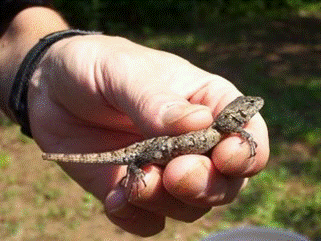
 ...and then a couple of slider turtles arrived to claim the bits of food that landed on the mud at the pond's edge. After having our fill of catfish and slider turtles, we left the lovely new deck area around the pond, and began turning over nearby logs and stones. One of the children found an Eastern fence lizard, which lost the end of its tail while being captured by a young participant. (The tail will grow back over time; lizards "drop" their tails as a means of distracting predators, giving them a chance to escape while their abandoned tail continues to wiggle.)
 We continued up the hill, off a trail and into the woods. Chigger Country, I was later to discover. Several participants, including myself, ended up with an unintended memento of our trip: a vast number of chigger bites around the ankles. The wooded area had many large rocks, but few creatures living under them, apart from the occasional ant colony. We returned to a grassy area near the nature center building, to visit with the resident sulcata tortoise. We gathered around his enclosure to watch him chowing down on various vegetables. Then we disbanded -- it was practically noon, and I had a long week of chigger-bite-scratching ahead of me....

 As we set out to look for local herps, I admit to feeling skeptical that, with such a large lively group of participants, we would actually find any. But all it took was some fish food sprinkled on the water of the small pond outside the nature center building, and first the catfish showed up for a feeding frenzy... ...and then a couple of slider turtles arrived to claim the bits of food that landed on the mud at the pond's edge. After having our fill of catfish and slider turtles, we left the lovely new deck area around the pond, and began turning over nearby logs and stones. One of the children found an Eastern fence lizard, which lost the end of its tail while being captured by a young participant. (The tail will grow back over time; lizards "drop" their tails as a means of distracting predators, giving them a chance to escape while their abandoned tail continues to wiggle.)We continued up the hill, off a trail and into the woods. Chigger Country, I was later to discover. Several participants, including myself, ended up with an unintended memento of our trip: a vast number of chigger bites around the ankles. The wooded area had many large rocks, but few creatures living under them, apart from the occasional ant colony. We returned to a grassy area near the nature center building, to visit with the resident sulcata tortoise. We gathered around his enclosure to watch him chowing down on various vegetables. Then we disbanded -- it was practically noon, and I had a long week of chigger-bite-scratching ahead of me....
Thursday, August 7, 2008
Turtles and Toads of the Chattahoochee Hill Country: Part One

On Thursday, July 10th 2008, Rick McCarthy ("Reptile Rick") and Valerie Hayes gave a presentation on "Turtles and Toads" -- a shortcut for herps ( a word that refers to both amphibians and reptiles). Rick (on the left) gave a splendid talk about snakes and lizards in the area; Valerie followed with a fascinating look at local frogs and toads (complete with recordings of their calls) as well as (of course!) turtles....
 The talks were highly informative, and Rick also brought several caged live snakes (venomous and nonvenomous) found in the Hill Country. Attendance was light, but the four participants who joined us indicated that they enjoyed the presentations very much. Both speakers gave their talks again a few weeks later, during Snake Day festivities at Cochran Mill Nature Center(Saturday, August 23rd).
Thursday, June 26, 2008
Hill Country Trees and Lichens: Part Two
Our Saturday outing for "Trees and Lichens" on June 21st began most inauspiciously. First I was awakened by a thunderstorm, followed by steady rain that only ended an hour before the scheduled start of the outing -- in time to leave the lichens and mosses "fat, happy, and green." Then, Sean called to leave a message that he was ill and could not join us, but was sending Malcolm Hodges in his stead. Malcolm is a renowned lichenologist in his own right, who has apprenticed with Sean and now "lichenizes" free-lance, when not birding or doing general ecological studies for The Nature Conservancy. Malcolm and David both met up with us at Hill Country Montessori School, joining us for the caravan down the road to Hutcheson Ferry Park. I remarked that it was a pity Sean was ill, only to learn from Malcolm that Sean had been struck with Rocky Mountain spotted fever, obtained from a tick that no doubt hitched a ride during one of his previous lichen outings! (I am delighted to add that he has since recovered fully.) Indeed, as Valerie has discovered doing fieldwork and as other longer-term residents of the area have noted, this summer has marked a banner year for all sorts of ticks in Georgia.
We (Malcolm, Sean, myself and my wife Valerie, and the four "regulars") got out of our cars and strode across the manicured (or at least well-mowed) park lawn toward a ridge and the rock outcrop habitat that lies a short distance beyond it. In seconds, Malcolm had found a tree branch covered in lichen and fungi, and was holding it aloft for all to examine. Time to break out the hand lenses, and enter a miniature yet amazing world of strange forms and colors.

 Malcolm, who had never been to Hutcheson Ferry Park before, was visibly excited when we arrived at the outcrop. His enthusiasm was contagious. Within minutes, we were down on our knees in wonder at the patterns and colors of mosses and lichens and flowering plants.
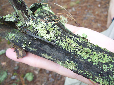 Every branch was full of Dr. Suess-like shapes, including a number of lichens in the genus Cladonia, which includes the British soldier lichen. I recall from my childhood finding a "batallion" of the red-headed British soldier lichen apothecia (fruiting bodies) atop a next-door neighbor's fencepost. On Saturday's outing, we found only a few, but discovered many other specimens, including one that was quite common on the outcrop, but which Malcolm had never seen before.
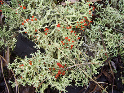 Above is a close-up of a few of the British soldier lichens we saw, intermixed with another Cladonia species that was gray-green and branched.
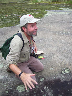 In another hand gesture that has become enigmatical with the passage of time (i.e., I forget what he was indicating in this photograph), Malcolm kneels on the outcrop, adjacent a small pool of water remaining from the rain that had fallen earlier that morning. Note his look of enthused delight. It was shared by all who attended the outing.
 At last we headed downhill from the outcroanp d into the forest, to try our hand at floodplain forest tree identification. Alas, the most noteworthy vegetation to catch our eyes at first was a very healthy stand of Microstigium viminium, also called Japanese stilt-grass, an invasive plant that tends to choke out all the native vegetation. Apart from trees and shrubs, the only other plants we saw in abundance were Japanese honeysuckle, which seemed to coexist pleasantly enough with the Japanese stilt-grass, while at the same time slowly choking the life out of every sapling they encountered. Still, the forest was lovely and green, and the Microstigium made the walking fairly easy, too.
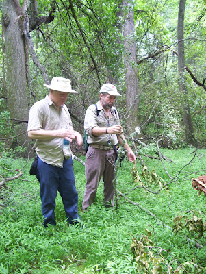 Above is another entry in my photo series of uncertain hand gestures. Looking at the photograph now, it almost looks like a sort of woodland low-impact martial arts could be underway. I include the photobecause somehow it is the only one I took that shows both David Morgan as well. Down in the forest, he was in his element, an expert in identifying tree types by bark and leaf, as well as sharing his reflections on the ecology of the woodland.
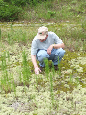
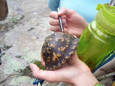 Unlike the toad photograph from Part One this month, this photograph does relate directly to our outing. Shortly after leaving the outcrop for the forest, Valerie encountered this beautiful male box turtle lurking under a shrub. Caught without her extensive collection of field equipment for box turtle studies, she "borrowed" this specimen in order to take some measurements (such as mass, body width, etc.), then carefully returned him to the very spot where we had found him, none the worse for his experience. In this photo, Valerie counts the rings on his carapace (upper shell) in order to obtain an estimate of his age. I was delighted that we chanced upon him, as his photo provides yet another opportunity to make a plug for our July Sense of Place workshop on Turtles and Toads. Co-led by "Reptile Rick" from Cochran Mill Nature Center and Valerie Hayes, herpetology grad student at the University of West Georgia, the event will include an evening talk at The Studio on Thursday, July 10th, plus a Saturday outing to Cochran Mill Nature Center on Saturday, July 19th. For more information, contact Clifford at senseofplace@southeastpbe.org.
We (Malcolm, Sean, myself and my wife Valerie, and the four "regulars") got out of our cars and strode across the manicured (or at least well-mowed) park lawn toward a ridge and the rock outcrop habitat that lies a short distance beyond it. In seconds, Malcolm had found a tree branch covered in lichen and fungi, and was holding it aloft for all to examine. Time to break out the hand lenses, and enter a miniature yet amazing world of strange forms and colors.
 Malcolm, who had never been to Hutcheson Ferry Park before, was visibly excited when we arrived at the outcrop. His enthusiasm was contagious. Within minutes, we were down on our knees in wonder at the patterns and colors of mosses and lichens and flowering plants.
 Every branch was full of Dr. Suess-like shapes, including a number of lichens in the genus Cladonia, which includes the British soldier lichen. I recall from my childhood finding a "batallion" of the red-headed British soldier lichen apothecia (fruiting bodies) atop a next-door neighbor's fencepost. On Saturday's outing, we found only a few, but discovered many other specimens, including one that was quite common on the outcrop, but which Malcolm had never seen before.
 Above is a close-up of a few of the British soldier lichens we saw, intermixed with another Cladonia species that was gray-green and branched.
 In another hand gesture that has become enigmatical with the passage of time (i.e., I forget what he was indicating in this photograph), Malcolm kneels on the outcrop, adjacent a small pool of water remaining from the rain that had fallen earlier that morning. Note his look of enthused delight. It was shared by all who attended the outing.
 At last we headed downhill from the outcroanp d into the forest, to try our hand at floodplain forest tree identification. Alas, the most noteworthy vegetation to catch our eyes at first was a very healthy stand of Microstigium viminium, also called Japanese stilt-grass, an invasive plant that tends to choke out all the native vegetation. Apart from trees and shrubs, the only other plants we saw in abundance were Japanese honeysuckle, which seemed to coexist pleasantly enough with the Japanese stilt-grass, while at the same time slowly choking the life out of every sapling they encountered. Still, the forest was lovely and green, and the Microstigium made the walking fairly easy, too.
  Above is another entry in my photo series of uncertain hand gestures. Looking at the photograph now, it almost looks like a sort of woodland low-impact martial arts could be underway. I include the photobecause somehow it is the only one I took that shows both David Morgan as well. Down in the forest, he was in his element, an expert in identifying tree types by bark and leaf, as well as sharing his reflections on the ecology of the woodland. Unlike the toad photograph from Part One this month, this photograph does relate directly to our outing. Shortly after leaving the outcrop for the forest, Valerie encountered this beautiful male box turtle lurking under a shrub. Caught without her extensive collection of field equipment for box turtle studies, she "borrowed" this specimen in order to take some measurements (such as mass, body width, etc.), then carefully returned him to the very spot where we had found him, none the worse for his experience. In this photo, Valerie counts the rings on his carapace (upper shell) in order to obtain an estimate of his age. I was delighted that we chanced upon him, as his photo provides yet another opportunity to make a plug for our July Sense of Place workshop on Turtles and Toads. Co-led by "Reptile Rick" from Cochran Mill Nature Center and Valerie Hayes, herpetology grad student at the University of West Georgia, the event will include an evening talk at The Studio on Thursday, July 10th, plus a Saturday outing to Cochran Mill Nature Center on Saturday, July 19th. For more information, contact Clifford at senseofplace@southeastpbe.org.
Hill Country Trees and Lichens: Part One
On Thursday, June 12th, renowned Georgia lichenologist Sean Beeching, along with University of West Georgia botany professor David Morgan, gave a presentation to SOP Workshop participants in The Studio at Serenbe Community. Sean regaled the half-dozen of us (myself, my wife Valerie, and four "regulars") with a speech on the nature of lichens, liberally augmented with a sampling of his collected field specimens. Afterwards, Dr. David Morgan talked about the trees of the Georgia Piedmont. He brought sample branches from each of the twenty trees, walking us through the process of telling them apart. I had a marvelous time, and learned a great deal more Southern trees that had previously been unfamiliar to me, such as sourwood and red maple. I'm not sure how I would do on a tree identification quiz, though....
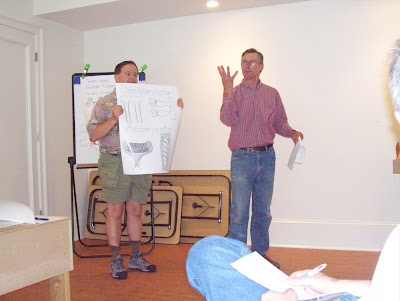 ...and then later in the talk, I played the role of Vanna White, holding up a diagram of the classification of lichenized fungi for the audience. In this photo, I think Sean is explaining the difference between basidiomycetes and ascomycetes, or maybe he is simply attempting to demonstrate the Vulcan "Live long and prosper" gesture from Star Trek?
 After the talk by Sean, and a brief introductory speech by David, out came all the tree branch specimens, and our work for the evening got underway. So many leaves, so little time....
 Here, David is explaining how to distinguish a loblolly pine from a slash pine from a red cedar from a red maple from a black cherry....
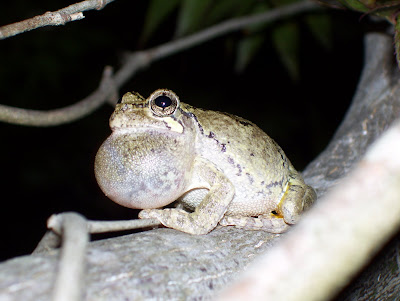 This photograph has nothing to do with the evening's presentations, except for the fact that it was taken by my wife Valerie the same evening, shortly after our return home from The Studio. This Cope's Gray Tree Frog was captured mid-song, and serves as an advertisement of sorts, or foreshadowing maybe, of the July Sense of Place workshop, entitled "Turtles and Toads". The talk is scheduled for Thursday the 10th of July at 6:30 pm, and the outing will take place at Cochran Mill Park at 9:00 am on Saturday, July 19th. (For further information, contact Clifford at senseofplace@southeastpbe.org.)
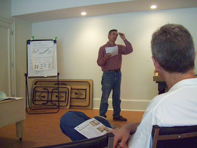
Above, Sean waxes lyrical about lichens...
 ...and then later in the talk, I played the role of Vanna White, holding up a diagram of the classification of lichenized fungi for the audience. In this photo, I think Sean is explaining the difference between basidiomycetes and ascomycetes, or maybe he is simply attempting to demonstrate the Vulcan "Live long and prosper" gesture from Star Trek?
 After the talk by Sean, and a brief introductory speech by David, out came all the tree branch specimens, and our work for the evening got underway. So many leaves, so little time....
 Here, David is explaining how to distinguish a loblolly pine from a slash pine from a red cedar from a red maple from a black cherry.... This photograph has nothing to do with the evening's presentations, except for the fact that it was taken by my wife Valerie the same evening, shortly after our return home from The Studio. This Cope's Gray Tree Frog was captured mid-song, and serves as an advertisement of sorts, or foreshadowing maybe, of the July Sense of Place workshop, entitled "Turtles and Toads". The talk is scheduled for Thursday the 10th of July at 6:30 pm, and the outing will take place at Cochran Mill Park at 9:00 am on Saturday, July 19th. (For further information, contact Clifford at senseofplace@southeastpbe.org.)
Sunday, May 18, 2008
Hill Country Gardens, Part Three
 After a picnic lunch at tables with white tablecloths amid the splendor of Dunaway Gardens, we caravanned north on Route 70 then east on the South Fulton Parkway to Wilkerson Mill Gardens, owned by Elizabeth (shown above) and Gene Griffith. Wilkerson Mill is a nursery open to the public, specializing in hydrangeas. Elizebeth joined us for an hour, talking about the history of her developing sense of place on the thirty acres where she and her husband live and work in the Chattahoochee Hill Country. She began by leading us into a sheltered corner of her garden sales area, to talk with us about creating inviting living spaces with plants.
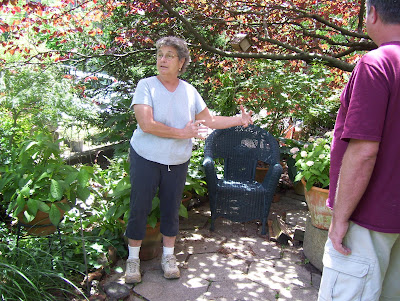 Then she led us on a ramble along some of the mown paths on her property. We wandered past a host of intriguing shrubs, some in bloom, others with fascinating leaves or patterns of growth.
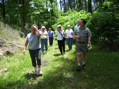 Elizabeth told us how she and her husband, around twenty years ago, first acquired the land and decided to move there to establish an orchard. As the land was cleared for planting, she began to feel terrible about all the destruction that was involved. She was told by a mentor that she should find the most stunning tree on the property, go to that tree, and ask for forgiveness for the desecration by pouring all the energy of the loss into that tree. She explained that one tree stood out by far as the one she had to visit. It was a white oak hundreds of years old, probably even older than the grist mill on the property that dates from the 1860s. Just the day before, she shared with us, the tree had fallen abruptly in a strong wind. The loss was not entirely surprising -- after the stress of severe drought last year, the storms of spring have done a tremendous amount of damage to trees, especially elder ones, in and around the Hill Country. Still, she explained, she feels the oak's demise deeply. Connection to place carries with it a susceptibility to the anguish of loss.
We came, at length, to where the great tree lay. The oak leaves were still green and fluttering in the light breeze. Amazingly enough, the tree fell in such a way as to block access to the mill, yet did not damage the historic structure in any way. It did relatively little damage in its fall, she explained, apart from flattening a pop-up camper belonging to a visitor who was doing some work on the property (who was not in it at the time, of course). We paused to admire the mill itself, with footings carefully shored up a few years back, by an Amish family from Michigan. Alongside the structure, the overshot wheel still stands in the millrace. This mill is the last of its kind, the only mill still standing relatively intact within the Chattahoochee Hill Country.
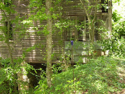 Our forward advance thwarted by the fallen oak, we retraced our path to some stone steps back up into the garden sales area. From there the group dispersed. Valerie and I were distracted by possible plants for our own three acres. We carried home in the back of our car a red buckeye, some Japanese painted ferns, and a Franklinia -- an understory tree that Valerie had been craving since our arrival in Georgia, named by William Bartram in honor of Benjamin Franklin, discovered in southern Georgia on his travels there, but now thought to be extinct in the wild. But that is another story, one that Mike Cunningham had shared with us nine days before....
Subscribe to:
Posts (Atom)
