 I inhabit a landscape of loss. I recall Shelby Foote, writer and historian of the Civil War, remarking (on Ken Burns' Civil War program) that the South is unusual in the country because it has had the experience of losing a war. But that is not all that it has lost. It has also lost the A horizon of its soil -- a layer of organic-rich "topsoil". Up to a foot of black earth once covered its red clay heart, the now-exposed iron- and clay-rich B horizon. All that is gone -- lost to King Cotton, and afterwards, lost to mismanagement as fields were abandoned during the Great Depression. Maybe, in a few thousand years, a new A horizon will develop. But for now, I am haunted by the sense of absence, an incomplete soil. And all around me, inscribed into the landscape, the gullies that once flowed with a slurry of soil and water, and the upland terraces where the cotton once grew. Looking closer, I see old fencelines with barbed wire, and Coca-Cola bottles from the 1920s (I discovered two across the road from my house), and rusting farm machinery of mysterious form and purpose. And I think about what once grew here, and the cattle that once roamed fields now grown to forests (and still roam other nearby fields).
Mostly, though, I think about the soil. There is a new soil survey for Fulton County -- 2008 -- and and older one (and more intriguing, for its age), from 1958. The soil names have all been changed in the interim, and the aerial photograph used as a base is correspondingly newer, too.
Nonetheless, my favorite local aerial photograph is the one above. It shows the crossroads of Goodes, southwest Fulton County, as it appeared from an airplane sometime in 1938 -- back when a lot of the erosion was still going on, when the topsoil was still on the move. Goodes is more noticeable on an aerial photograph or map than it is from the ground -- the roads come together in a distinctive pattern that lends character to what otherwise would be just any other highway intersection in what passes for "country" outside Atlanta. From the ground, Goodes is just a sign like an old-time gas station kind, easily overlooked.
 But in the aerial photograph, I can spot Goodes among dozens of other highway crossroads. Rico residents may have the old schoolhouse that is now City Hall, Police Station, Community Center, and Library all rolled into one (and they may have the volunteer firehouse, too), but we have that strange crossing of roads where the north-south Atlanta Newnan Road is offset, with Rico angling northwest in-between its two sections. A geologist, examining the crossroads, would declare Hutcheson Ferry Road a fault line, and pronounce the movement right lateral.
Hutcheson Ferry is hardly a plate tectonic boundary -- we are fully in the United States, deep in the heartland, as the soundly Republican tone to the political signs on homeowners' lawns remindes me. But it is a boundary of another sort -- a drainage divide, separating small subbasins within the Chattahoochee River Watershed. To the north, along Rico Road and in the woods just across the street from my house, a brook flows in a narrow but deeply-incised channel, eventually joining another stream, flowing into Longino Creek and then at last into White Oak Creek, and thence into the Chattahoochee River. To the south, the water flows into ephemeral gullies, like the one behind Hill Country Montessori School, and then into Cedar Creek, which briefly serves as county line between Fulton and Coweta Counties.
All this shows that, if not the center of the universe, Goodes is a fascinating place to be. But, as Brian Swimme the theoretical cosmologist reminds us (to go from the crossroads to the cosmic for a moment), we are in an expanding universe where every point is a center of expansion. So every place is the center of the universe. Goodes is as good an axis mundi as any other one, and perhaps a bit more distinctive when viewed from above (or nowadays, from Google Earth). But other spots are intriguing in their own way, if you slow down enough to read them -- to study their chorography. That, I suppose, is the irony of being a proponent of reading the landscape -- I become proficient at reading stories in the immediate earth where I live, but I do so with the hope of encouraging others to do the same in their own places.
The stories are different, perhaps, though too many are, I fear, variations on a theme of loss. After all, no places on this continent will feel again the whirlwind force of a visit by a sky-darkening flock of passenger pigeons, and no tree will shake with the tropical chatterings of a flock of Carolina parakeets. The elm tree is gone, apart from a large specimen I found along a trail at Etowah State Historic Site. And the chestnut is gone, too, apart from a few tentative saplings that die young and diseased (awaiting a naturalist equivalent of A. E. Housman to celebrate them), and a dozen that made National Public Radio news last year for lingering into adulthood on the slopes of Pine Mountain, well south of here.
I was the speaker in our Sense of Place Series this month, though I did not cover anything I wrote above (except the lost topsoil part). I drew upon the work of an ecologist at the University of West Georgia, Joe Hendricks, presenting one of his Terrestrial Ecology PowerPoint presentations to offer the half-dozen audience members a sense of the landscape history of this region. Then I showed the Goodes aerial photograph from 1938 -- a travel back in time to when terraces were still bare -- covering parts of the land with patterns akin to suminagashi, the inky swirls of Japanese marbled paper. Then I showed them images from a walk in the woods I took last year, with scenes evoking stories in the landscape.
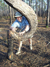
Above is what I wanted to say, or begin to say, or struggle to make sense of -- the mysterious force that compels me to find new stories in the land, the way I have become so taken with the crossing of roads I walk every day, the way I thrill to the discovery of another trace of abandoned fenceline, the sorrow I feel when I look across a gully at a white oak over a hundred years old, once a pasture tree and now, roots exposed, holding for life onto a mound of soil. And I think of the distance between that oak and me, a distance once filled with earth, now not capable of being bridged. It is a distance in space, of course, but also in time, back to a time when the soil was black not red, and the forests were composed of oak and hickory, not these weeds of loblolly and sweetgum I now find cropping up wherever I leave the lawn unmowed. We cannot go back -- Georgia will never again be the wilderness that William Bartram explored, or where, centuries earlier, Hernando DeSoto first encountered the remnants of the Mississippian civilizations (once called "The Moundbuilders"). The gullies are largely stable now, except perhaps after a heavy rainstorm. Then, briefly, the water may trace out with muddy fingers the gullies' former paths, leaving behind a thin blanket of silt in its passage over pine needles and sweetgum leaves and branches and bare earth.

No comments:
Post a Comment